 Release 7.2
This document provides information about the new features and improvements in
the most recent release of BS Contact GEO.
In depth technical documentation is available in the
BS SDK.
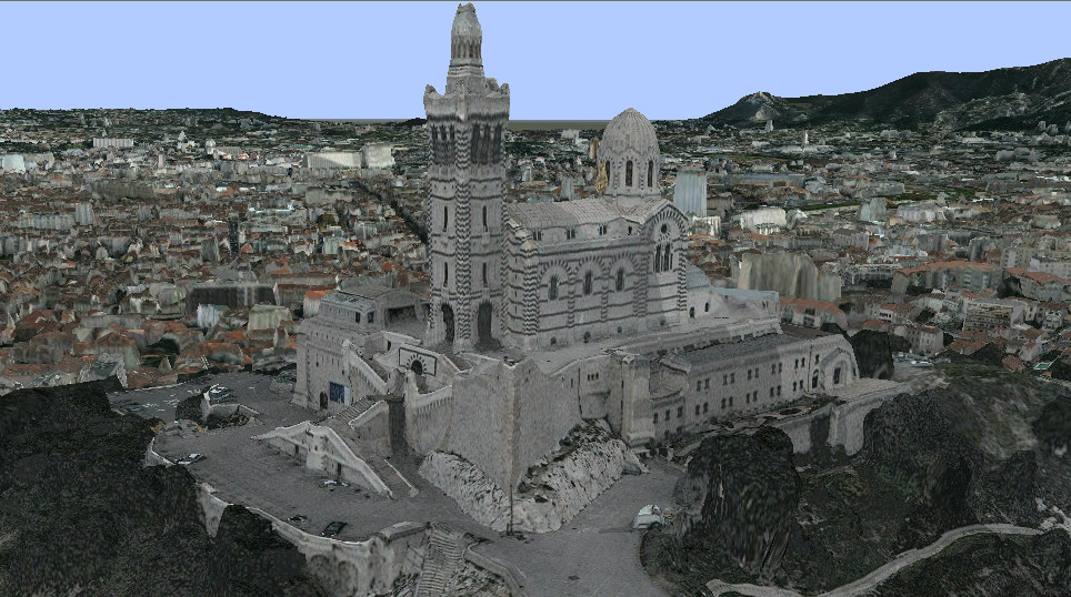
Marseille, France. High-resolution 3D tiles. Automatically generated.
BS Contact Geo now supports the full range of geospatial nodes specified by X3D.
See
Geospatial component for a detailed reference.
BS Contact Geo also offers these additional nodes:
See the SDK for further details on these nodes.
The CityGML format represents 3D urban models combined with meta-information. It is an open XML standard provided by the Open Geospatial Consortium (OGC). See http://www.citygml.org for further details.
CityGML-files can be included using the standard Inline node:
Inline { url "./myCityGMLModel.gml" }
With the latest version of BS Contact Geo you can now add KMZ models to your geospacial scene. KMZ files are compressed Collada files with an additional KML location-file. See the KML Documentation for further details.
KMZ-files can be included using the standard Inline node:
Inline { url "./myKMZModel.kmz" }
The GeoSphere node now supports the use of the elevation-data-format HF2 / HFZ / HF2.GZ. The compression in the basic HF2 files uses difference encoding of lines. Additionally HFZ files are compressed using zip-compression.
[ return to contents ]
The GeoSystem node has been extended to allow a vast amount of cartographic projections, ellipsoids and coordinate systems.
GeoSystem strings may now contain projection descriptions as defined by the PROJ.4 - Cartographic Projections Library
See the SDK on how to use these projections.
The navigation modes GeoFly and GeoExamine now support the use of a 3D mouse. GeoFly is the default navigation mode and behaves similar to the navigation of other common GIS applications.